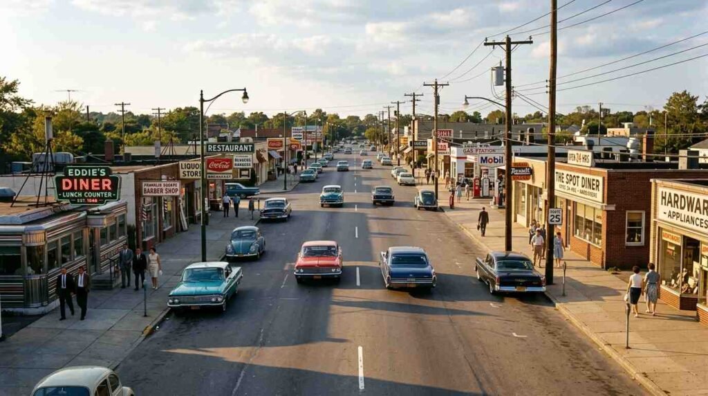
Before Robert Moses pushed a highway through the interior of Long Island, Route 25 through what is now Dix Hills was a working road. Not scenic, not landscaped, not the kind of stretch that gets written up in regional travel features — but working. Diners, lunch counters, filling stations, roadhouses that fed the men who worked the farms and light industry of mid-Island Suffolk. The food was honest. The margins were thin. The clientele arrived in trucks.
Then the Long Island Expressway arrived, and the road starved.
A Timeline Written in Asphalt
The LIE’s march through Suffolk County happened in stages, each one documented in public record. In 1962, the highway crossed the Nassau-Suffolk border, terminating at Exit 49 at Route 110 in Melville. A year later, in 1963, it extended east to Exit 52 at Commack Road in Dix Hills. By 1964 it pushed further to Exit 57 in Islandia, and by the end of 1966 had reached Holbrook.
For Route 25 through this corridor — the old Middle Country Road, one of colonial Long Island’s three original east-west highways, documented in the 1703 General Assembly’s highway commission records — the LIE’s arrival was not a complement. It was a redirect. Traffic that had moved along the surface road found a faster channel. The 1960s commuter chose speed. The highway won by default.
What the highway could not easily replicate was the distributed, street-level economy that Route 25 supported. You can build an exit ramp. You cannot build a lunch counter.
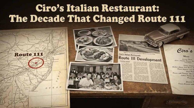
The Diner Belt That Route 25 Supported
The commercial strips that ran through Dix Hills, Melville, and Huntington Station along Route 25 and its adjacent local roads served a specific population: agricultural workers, light industrial employees, the families of men who worked the Bethpage corridor before Grumman became the island’s dominant employer. Newsday archives from the 1950s and 1960s document the density of small food and service businesses along these corridors — lunch counters, short-order spots, the diner-adjacent establishments that were the backbone of mid-century Suffolk County commercial real estate.
These businesses had a common economic logic: low rent, high throughput from a captive workforce, and no need to compete for the discretionary dollar because the clientele had nowhere else practical to stop. That logic died when the captive audience got a faster road.
The establishments that didn’t close moved, or tried to. Several relocated toward the new LIE service roads, hoping to capture exit-ramp traffic. Most didn’t survive the transition. Exit-ramp customers in the 1960s were already beginning to be sorted by the national chain model — Howard Johnson’s, the early franchise operations that understood the highway customer in a way that the Route 25 lunch counter owner did not and could not.
The Half Hollow Hills Historical Society and Huntington Town archives contain records and photographs of this pre-expressway commercial landscape, including the business activity along Route 25 through Melville and the Dix Hills area. What those records show is a corridor that was functional and dense in 1955 and commercially gutted by 1975.
The Zoning Character Left Behind
Here is the part of this story that matters for anyone looking at property in Dix Hills today.
When the commercial strip along Route 25 through Dix Hills emptied out, the town didn’t rezone for new commercial development. It didn’t attract the chain retail that filled the Route 110 corridor in Huntington Station. What it did — largely by default — was preserve a residential interior. The parcels that had housed lunch counters and filling stations were absorbed, converted, or simply left at the scale of their original use. The zoning buffer between the Route 25 commercial fringe and the residential streets running north and south stayed intact.
The result is the Dix Hills real estate character that exists today: large residential lots, relatively low commercial density, a neighborhood that reads as quiet and deep-setback even by Long Island standards. That quietness has a price tag. Dix Hills consistently ranks among the more expensive zip codes in Suffolk County, not because it has a waterfront or a downtown but because the absence of commercial intrusion makes the residential streets genuinely livable.
This is a textbook case of how infrastructure trauma, absorbed over decades, produces an accidental amenity. Nobody planned Dix Hills as a low-density residential enclave. It became one because the highway took the commercial traffic away and the land use never recovered to absorb new development. What looks like a planning success is actually a planning absence.
The Dead Zone in Commercial Terms
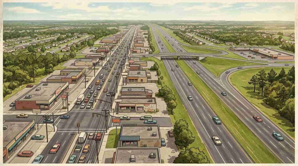
Walk Route 25 through Dix Hills today and you will not find a diner. You will not find a lunch counter. You will find a gas station, a few strip mall anchors scattered along the highway’s edge, and the particular retail desolation of a corridor that never rebuilt itself after losing its customer base sixty years ago.
Compare this to the Route 110 stretch through Huntington Station, which had direct interchange access to the LIE and rebuilt around that access — successfully, if chaotically. Or to the service road retail that clusters around Exits 49 and 51 in Melville and Dix Hills, which optimized for the exit-ramp customer and developed accordingly.
The Route 25 stretch through the middle of Dix Hills is a commercial dead zone not because demand for food and services dried up. The residential population is substantial and affluent. It’s a dead zone because the highway cut the customer flow that had supported the existing businesses, the existing businesses didn’t survive, and the zoning and land character that developed in the absence never invited the scale of commercial replacement that would have made new food-service concepts viable.
In economic geography, this is called a “corridor bypass effect.” In plain terms: the road that was supposed to make things more accessible made one strip of things inaccessible and slowly killed everything that had organized itself around the old route.
What Buyers Should Know
Dix Hills is not a secret. The school district — Half Hollow Hills — is one of the most consistently regarded in Suffolk County. Lot sizes trend large. The residential streets that run off Route 25 and the adjacent connector roads offer the kind of setback-from-traffic quiet that is genuinely difficult to find in western Suffolk without paying waterfront prices.
But the absence of a walkable food economy is real. There is no diner. There is no Main Street. There are diners and casual restaurants within a reasonable drive — the Route 110 corridor, the Commack Road strip — but the kind of neighborhood food infrastructure that builds itself around daily foot traffic does not exist here, and by the logic of what happened in the 1960s, it is unlikely to.
For the buyer who values residential quiet, large lots, and school district consistency over walkability and neighborhood commercial amenity, Dix Hills is a strong argument. For the buyer who wants to be able to walk to breakfast, it is not.
Pawli at Maison Pawli a Boutique Modern Realty works with buyers across Suffolk County who are navigating exactly these trade-offs — neighborhoods where residential character and school quality are strong but the commercial layer is thin. Understanding the history behind that absence is part of understanding what you’re actually buying.
Related reading: Robert Moses and the Asphalt Axe — an earlier post that traces how Moses’s highway infrastructure permanently reshaped Long Island’s community fabric.
This post is for informational purposes only — consult a licensed attorney or financial advisor for your specific situation.
Sources
- LongIsland.com: Crazy Facts About the Long Island Expressway
- Dix Hills-Melville Historical Association: History
- herricks62to64.com: LIE Construction Timeline, Suffolk County
- Molloy University: Long Island Transportation History
- Huntington Town Zoning Board: Public zoning maps and variance records (public record)
- Newsday historical archives — accessible via public library digital collections