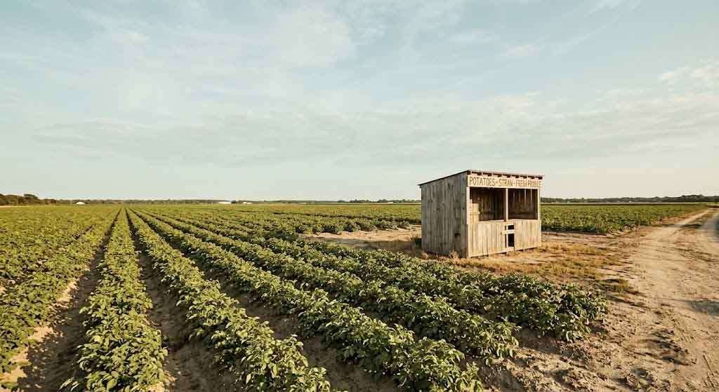
Seventy thousand acres. That is how much of Suffolk County was under potato cultivation at its peak in the 1940s. Fields ran from Riverhead east to the North Fork and south toward the bays, broken only by the occasional farmhouse, a stand of oak, a dirt road leading nowhere much. The Peconic was a working waterway then, not a luxury address. The East End was a place people farmed, not a place people fled to.
Today, fewer than 3,000 acres remain in active potato production across Suffolk County. The rest? Subdivisions, strip malls, McMansion clusters with names like Meadow Ridge or Fox Run — named, with no small irony, after the things they eliminated. The transformation took about sixty years and was considered, at the time, progress.
How Potatoes Fed an Island — and a Nation
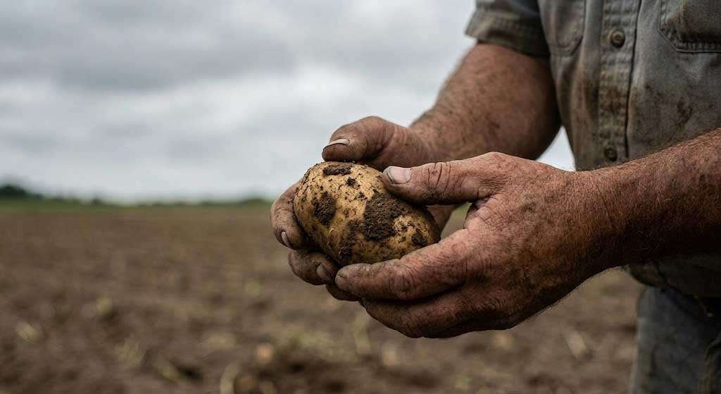
Long Island’s potato history is not incidental. Suffolk County was one of the most productive agricultural counties in the northeastern United States through the mid-twentieth century. The soil east of the Pine Barrens — light, sandy, well-drained — was close to ideal for potatoes. Combined with the island’s moderate maritime climate and proximity to New York City markets, East End growers were feeding the city and supplying chips manufacturers for decades.
At its height, the industry employed thousands of seasonal laborers, supported a network of seed companies, farm equipment dealers, and cold-storage warehouses, and gave the region a working-class economic identity that had nothing to do with the Hamptons. The Peconic River towns — Riverhead, Calverton, Aquebogue — ran on agricultural wages. The land was worth what it could grow.
Cornell Cooperative Extension of Suffolk County documented this trajectory in agricultural census data stretching from the postwar era forward. The numbers track a collapse that was not dramatic so much as relentless: each decade, fewer farms, fewer acres, fewer families willing or able to hold on.
The Mechanics of Disappearance
What replaced the farms was not some accident of economics. It was a set of policy decisions, tax structures, and market forces that made subdivision more profitable than farming — and that made holding farmland across generations nearly impossible.
Property taxes were the blunt instrument. As residential and commercial development spread westward from New York City in the postwar boom, assessed land values across Suffolk County rose whether the land was producing anything or not. A family that had been farming a hundred acres since the Depression suddenly held an “asset” — on paper — that generated enormous annual tax bills and almost no income proportionate to that valuation. The choice was stark: sell to a developer or borrow against land to keep farming, a cycle that usually ended in the same place.
Inheritance was the second mechanism. When a potato farmer died, his land passed to children who had spent their adult lives building lives elsewhere — in Queens, in Westchester, in Islip. They did not farm. They did not want to farm. They wanted the money the land represented, and a developer was always willing to pay it.
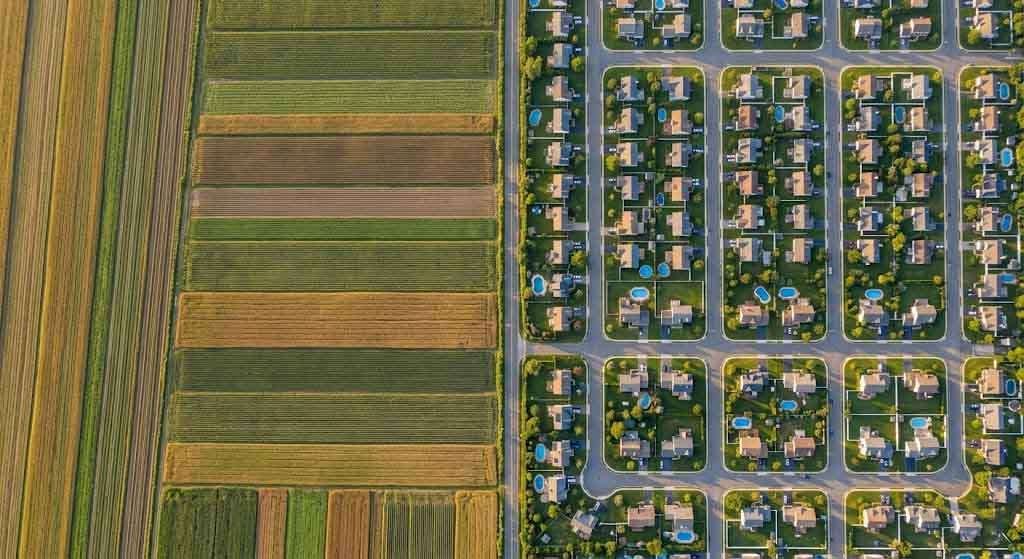
By the 1970s and 1980s, the pattern was locked in. Subdivisions moved east along the Long Island Expressway like a tide. The Hamptons, which had been genuinely modest — a mix of fishermen, farmers, and summer visitors — began its transformation into something else entirely. Land that once sold by the acre for its agricultural potential now sold by the lot for its social cachet.
Sustenance to Status: The Class Story Nobody Tells
The agricultural decline of the East End is typically narrated as economic inevitability. Farming became less profitable. Land became more valuable. People made rational choices. That story is technically accurate and almost entirely dishonest.
What actually happened was a class transformation so complete that it erased the working landscape and replaced it with one calibrated entirely to wealth and leisure. The families who had farmed those 70,000 acres were not offered a seat at the table being set for them. They were the table.
The Peconic Land Trust, founded in 1983, has done significant work documenting what was lost and fighting to preserve what remains. Their land use reports track not just acreage but the breakdown of what replaced farmland — residential subdivisions account for the largest portion, with commercial development and institutional use trailing behind. The Trust has protected thousands of acres through conservation easements, but they are fighting a rearguard action against a transformation that was largely complete before the organization existed.
The farms that remain are not the farms of the 1940s. They are specialty operations — wine grapes, organic vegetables, farm stands serving the weekend market. They are, in many ways, luxury agriculture: farms that survive because affluent second-home buyers want proximity to them, want to buy heritage tomatoes and duck eggs on Saturday morning. The economics of farming the East End today depend entirely on the people who displaced the original farmers.
That is a particular kind of irony, and it is not lost on the families still working the land.
What 3,000 Acres Means in Practice
Three thousand acres of farmland in a county that covers over 900 square miles sounds like it might be enough. It is not. Agricultural viability at county scale requires critical mass — seed suppliers, equipment dealers, labor networks, cold storage. When the industry contracts below a certain threshold, the infrastructure that supports it disappears, and the remaining operations face costs that make them economically marginal no matter how well-managed.
Cornell Cooperative Extension continues to support Suffolk County agriculture, but the agricultural system they are supporting is fragmentary compared to what existed a generation ago. The North Fork wine industry has been a genuine success story — it created a new agricultural economy from a depleted one — but it is not potato farming. It is a hospitality industry that happens to grow grapes.
Meanwhile, the subdivisions continue. Not at the pace of the 1970s — most of the buildable land east of Riverhead has been spoken for — but incrementally, parcel by parcel, as remaining farm families age out and conservation organizations struggle to raise matching funds.
The Market That Ate the Farm
Real estate professionals working the East End today are navigating a market that was built on erasure. A property in Bridgehampton or Sagaponack is priced the way it is because the farms that surrounded it were sold off decades ago, because scarcity was manufactured through development, because the working landscape was replaced with a luxury one.
That is not a criticism of the market — markets respond to what they are given. But it is worth naming clearly what was given and what was taken in the process.
Pawli, Broker at Maison Pawli Realty, has watched this dynamic play out across the North Shore and East End for years. “The story of Long Island land is always a story of transition,” Meyer says. “The question buyers and sellers need to ask is what the land was, what it is now, and whether the value being priced in reflects the real history of a place.” For families navigating the East End market today — whether buying, selling, or holding — understanding that history is not optional. It is the context for every number on the listing sheet.
You can search current North Shore listings at heritagediner.com/properties/.
What Gets Buried When the Fields Go
Something specific is lost when farmland is subdivided that goes beyond acreage counts and economic statistics. It is the particular quality of a landscape that has been tended for generations — the way a field reads differently from a lawn, the way working land smells, the way its edges hold wildlife and water differently from a development parcel.
Long Island Potato Candy, of all things, offers a small window into that lost world. In a piece I wrote about the confection that East End farm families made during the 1940s as sugar rationing bit into daily life, the recipe itself was a document — proof that the people who farmed those 70,000 acres were inventive and resourceful and rooted in a specific place.
The fields are mostly gone. The culture that grew them is fading faster than the acreage data suggests. What remains are conservation easements, a few family operations, a wine industry, and a weekend farmer’s market aesthetic that the original potato farmers would have found completely alien.
The dirt that grew dinner now grows something else. Whether that is progress depends entirely on who you are asking — and whether you were the one who sold it or the one who bought it.
Sources: – Peconic Land Trust, Land Use Reports and Conservation Easement Data: peconiclandtrust.org – Cornell Cooperative Extension of Suffolk County, Agricultural Data and Farm Reports: cce.cornell.edu/suffolk – USDA National Agricultural Statistics Service, New York State Agricultural Statistics: nass.usda.gov – New York State Department of Agriculture and Markets, Suffolk County Agricultural District records
Tags: real estate, long island, north shore, history