Stand on a corner in Manhattan on a Tuesday afternoon and you’ll witness organized chaos: thousands of pedestrians crossing in every direction, hundreds of cars inching through traffic, delivery trucks double-parked, buses stopping and starting, cyclists weaving through gaps, street vendors working their carts, construction crews blocking lanes, and police redirecting flow around it all.
Now multiply that scene by every intersection in a city of 8.3 million residents, plus 4 million daily commuters, plus 60+ million annual tourists. Add in underground subway systems transporting 4.5 million riders daily, water systems delivering 1 billion gallons, waste systems hauling 14,000 tons of trash, and power grids feeding 11 million megawatt-hours.
How do you manage a system that complex? Increasingly, the answer is: AI, sensors, and data.
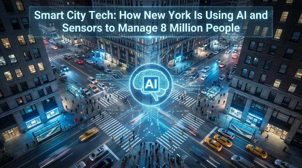
Welcome to New York City’s smart city infrastructure — the largely invisible technological nervous system that keeps the world’s most complex urban environment functioning. In 2026, sensors and artificial intelligence are becoming as essential to NYC’s operations as roads and bridges.
And most people have no idea it’s happening.
What Makes a City “Smart”
The term “smart city” gets thrown around loosely. Every mayor claims their city is embracing technology. But what does it actually mean?
A smart city uses networked sensors, IoT (Internet of Things) devices, and artificial intelligence to collect real-time data about urban systems, analyze that data, and make better decisions about resource allocation and service delivery. It’s about replacing guesswork with information.
New York was ranked the #1 smart city in North America in 2023. By 2026, the city has deployed thousands of sensors and IoT devices across all five boroughs. These sensors measure everything from air quality to pedestrian traffic to water pressure to subway delays.
The data flows to command centers where AI systems analyze patterns, predict problems, and alert human operators. The goal isn’t to replace human decision-makers but to give them better information faster.
The Smart City Testbed: NYC’s Innovation Playground
In 2023, New York’s Office of Technology and Innovation (OTI) launched the NYC Smart City Testbed Program. The concept is simple: allow companies and universities to pilot emerging technologies in real-world NYC environments for 6-9 months before committing to permanent deployment.
It’s a brilliant approach. Instead of making million-dollar bets on unproven technology, the city tests first. Companies get real-world data to refine their products. If pilots succeed, they scale citywide. If they fail, the city learned valuable lessons cheaply.
By 2026, the Testbed has run dozens of pilots across multiple areas:
Air Quality Monitoring: Three systems across NYC that actively pull pollution out of the air while measuring pollutant levels (CO2, NO2, particulate matter). These aren’t replacing long-term pollution reduction strategies, but they provide real-time data and marginal improvements in heavily polluted areas.
Computer Vision for Infrastructure: AI-powered drones and robots scan building facades and roofs, identifying structural issues before they become dangerous. The Department of Citywide Administration Services (DCAS) uses this to prioritize maintenance on the 9,000 buildings the city owns.
LiDAR Traffic Analysis: The Department of City Planning uses LiDAR scanners to track vehicle movements associated with industrial activity. This helps planners understand how new developments impact traffic patterns and make data-driven zoning decisions.
Protected Bike Lane Monitoring: Computer vision systems captured 150,000 roadway images across 320 kilometers of bike lanes in just eight weeks. The AI identifies obstructions, wear patterns, and safety issues. Previously, this required manual inspections taking months.
Pedestrian Counting: Anonymized pedestrian-counting sensors deployed in plazas, open streets, and holiday markets measure foot traffic and dwell times. This data informs decisions about where to allocate resources, how to design public spaces, and whether specific programs are working.
Augmented Reality for Community Engagement: At the site of a new recreation center in Queens, the city deployed AR technology allowing community members to scan QR codes and see 3D renderings of the planned facility overlaid on the actual site. This helps residents understand what’s coming to their neighborhood before construction begins.
Each pilot generates insights that inform future city planning. As NYC CTO Matthew Fraser put it: “The NYC Smart City Testbed Program embodies our mindset that there are no failures, only learning opportunities.”
Managing Traffic: The Most Visible Smart City Application
Traffic management is where NYC’s smart city technology is most apparent — if you know what to look for.
Real-Time Traffic Monitoring: Computer vision cameras and sensors at major intersections track vehicle flow, pedestrian crossings, and congestion in real time. This data feeds AI systems that identify patterns and predict bottlenecks.
When the George Washington Bridge backs up, AI can reroute traffic through alternative routes before gridlock spreads. When an accident closes lanes on the FDR Drive, the system adjusts traffic signal timing across Lower Manhattan to prevent cascade failures.
Predictive Traffic Management: AI doesn’t just react to current conditions; it predicts future states. By analyzing historical patterns, weather, events calendars, and real-time data, the system forecasts traffic conditions hours ahead. This allows preemptive intervention.
For example: Concert at Madison Square Garden + rain forecast + evening rush hour = predictable nightmare. The AI flags this combination three hours early, allowing traffic controllers to adjust signal timing, deploy extra personnel, and notify drivers.
Smart Curb Management: A pilot program in partnership with AIWaysion monitors curb space usage — tracking dwell times, turnover rates, double-parking activity, and vehicle types (passenger cars, trucks, cargo bikes). The data reveals when and where curb space is underutilized, informing pricing and regulation decisions.
Curb space represents prime real estate in NYC. Better management translates to reduced congestion, improved delivery efficiency, and increased city revenue from appropriately priced curb access.
Multi-Modal Street Analysis: Computer vision systems analyze how New Yorkers actually use streets — not just cars, but pedestrians, cyclists, e-scooters, and delivery vehicles. This data informs street redesign decisions.
Should this street be converted to a bike lane? The data shows 500 cyclists per hour during rush hour but only 100 cars — clear case for conversion. Should this plaza remain permanently pedestrianized? The sensors show 2,000+ daily users with average dwell times of 45 minutes — yes, keep it.
The Subway: Underground Intelligence
New York’s subway is the nation’s largest mass transit system, with 472 stations and 665 miles of track transporting 4.5+ million riders daily. Managing this system requires massive technological infrastructure.
Predictive Maintenance: The MTA (Metropolitan Transportation Authority) has retrofitted subway cars with AI-enabled sensors that detect and analyze potential track defects. Google Pixel smartphones mounted to axles combine advanced camera systems with AI to identify issues before they cause delays or failures.
This shift — from reactive to predictive maintenance — saves millions. A detected crack gets repaired during off-peak hours rather than causing emergency service disruptions.
Camera Systems and AI Monitoring: Over 15,000 cameras throughout the subway system and on 6,000+ subway cars generate constant video feeds. In 2026, the MTA is exploring whether AI can monitor these feeds to detect weapons, unattended items, or even predict crowd surge events.
This technology raises privacy concerns. Critics worry about surveillance overreach and accuracy (false positives incorrectly flagging umbrellas as weapons, for instance). The MTA emphasizes that AI is a tool to enhance human decision-making, not replace oversight.
Crowd Flow Management: Sensors at stations track crowd density in real time. When platforms become dangerously crowded, the system alerts station managers and can adjust train frequency. During events like New Year’s Eve or major sporting events, this prevents dangerous crushes.
Water and Waste: Invisible Infrastructure
Less visible but equally important are smart systems managing water and waste.
Smart Water Infrastructure: Sensors throughout NYC’s water system monitor pressure, flow, and quality. AI analyzes this data to predict pipe failures before they happen, enabling preemptive repairs that prevent costly water main breaks.
New York delivers 1 billion gallons of water daily through 6,800 miles of pipes. Many pipes are over 100 years old. Predictive maintenance prevents catastrophic failures and reduces water waste.
Waste Management Innovation: NYC generates 14,000 tons of trash daily. Managing collection and disposal efficiently is critical.
AI-powered waste monitoring systems (like SmartEnds’ Visnline) use cameras to analyze waste as it enters bins, trucks, and recycling stations. The system identifies contamination in recycling streams (“plastic bags detected in paper recycling”), monitors illegal dumping, and optimizes collection routes.
Smart bins equipped with sensors detect fill levels and communicate when they need emptying. This allows the Sanitation Department to optimize routes dynamically rather than running fixed schedules. Bins that fill slowly get serviced less frequently; high-traffic locations get more attention.
The result: fewer truck miles, lower fuel costs, reduced emissions, and cleaner streets.
Energy Grid: Powering 8 Million People
New York’s power grid is critical infrastructure. Blackouts aren’t just inconvenient — they’re dangerous.
Smart Grid Monitoring: Sensors throughout the electrical grid detect load imbalances, equipment failures, and unusual consumption patterns in real time. AI predicts when substations or transformers will fail, enabling preemptive replacement.
During heat waves — when air conditioning demand spikes — the system identifies neighborhoods at risk of brownouts and can dynamically reroute power or activate demand response programs.
Energy Consumption Analytics: Building-level sensors (required under Local Law 97) track energy usage in real time. This data helps building managers optimize efficiency and helps the city understand consumption patterns.
Buildings account for 70% of NYC’s greenhouse gas emissions. Smart monitoring is essential to meeting climate goals (50% emissions reduction by 2030).
Public Safety: Walking the Privacy Line
Smart city technology intersects uncomfortably with public safety — where does useful monitoring become invasive surveillance?
Emergency Communications Vehicle (ECV-1): NYC deployed a specialized emergency communications vehicle equipped with advanced networking equipment. During disasters or major events, ECV-1 can extend network connectivity for city agencies and first responders, ensuring communications remain operational even if primary systems fail.
The vehicle can replicate all land and mobile radio communications from all city agencies and interoperate with state and federal partners. During emergencies, this redundancy is critical.
Gunshot Detection: Some cities deploy acoustic sensors that detect gunshots and triangulate locations, alerting police within seconds. NYC has experimented with this technology in limited areas. It’s controversial — privacy advocates argue it enables surveillance without meaningful safety improvement.
Crime Analytics: NYPD uses AI to analyze crime patterns and predict where crimes are likely to occur, enabling targeted patrols. This approach reduced certain crimes in pilot areas but raises concerns about bias and over-policing of minority neighborhoods.
NYC is trying to balance public safety benefits against civil liberties concerns. The city recently passed legislation creating an Office of Algorithmic Accountability tasked with analyzing AI tools, incorporating public input, and ensuring transparency.
Public Engagement: Bringing Citizens Into the Process
Smart city technology isn’t just about sensors and AI — it’s about engaging residents in urban planning.
Public Engagement Sessions: The OTI holds regular sessions at libraries where residents learn about smart city pilots and provide feedback. This transparency builds trust and ensures technology serves community needs rather than imposing solutions top-down.
Augmented Reality Visualization: The recreation center AR pilot mentioned earlier is part of broader efforts to help communities visualize proposed changes. Imagine scanning a QR code at a proposed park site and seeing a full-scale 3D rendering of the finished park overlaid on empty land. This helps residents engage meaningfully with planning decisions.
Open Data Platforms: NYC publishes vast amounts of city data on NYC Open Data (data.cityofnewyork.us). Developers, researchers, and journalists use this data to build tools, conduct analyses, and hold the city accountable.
This radical transparency wasn’t required — the city chose it as part of its smart city philosophy. Residents deserve access to data about their city.
The Long Island Relevance: Lessons for Local Government
Long Island isn’t New York City. Nassau and Suffolk counties lack NYC’s density, budget, and technical infrastructure. But smart city lessons apply to suburban contexts.
Traffic Management: Long Island suffers terrible traffic, particularly on the LIE and Northern State. Smart traffic management systems using AI to adjust signal timing and predict congestion could dramatically improve flow.
Waste Optimization: Even suburban waste collection could benefit from smart bins and route optimization. Towns pay for waste removal — reducing costs benefits taxpayers.
Water Infrastructure: Long Island’s water comes from underground aquifers. Smart monitoring could detect contamination, predict well failures, and optimize water usage.
Public Transit: While Long Island lacks subway systems, the LIRR could benefit from predictive maintenance and AI-powered scheduling to reduce delays.
Energy Management: With rising electricity costs and climate concerns, smart grid technology would help Long Island residents reduce consumption and costs.
Several Long Island municipalities have begun small smart city pilots. Brookhaven deployed smart streetlights that reduce energy consumption by 80%. Hempstead is testing smart parking systems. These are modest starts, but they’re starts.
The challenge is funding. NYC has resources Long Island towns lack. But grants from state and federal programs specifically target smart city initiatives. With strategic planning, Long Island could deploy smart infrastructure incrementally.
The Challenges: Technology Isn’t a Silver Bullet
Let’s acknowledge smart city limitations and challenges:
Privacy Concerns: More sensors mean more surveillance. New Yorkers worry about who controls data, how it’s used, and whether it enables authoritarian overreach. The city must balance utility with civil liberties.
Equity Issues: Smart city benefits must reach all neighborhoods. If technology only serves affluent areas, it exacerbates inequality. NYC commits to deploying sensors equitably, but monitoring this is essential.
Cost: Smart city infrastructure is expensive. Sensors, networking, data centers, AI systems, and personnel cost billions. NYC can afford this; smaller cities and towns struggle.
Maintenance: Sensors break. Networks fail. Systems require ongoing maintenance. The initial deployment is one cost; perpetual upkeep is another.
Hype vs. Reality: “Smart city” has become a buzzword. Vendors overpromise and underdeliver. Cities must carefully evaluate what actually works versus what sounds impressive in presentations.
Cybersecurity: Connected systems are vulnerable to hacking. A successful attack on NYC’s water or power systems could be catastrophic. Smart cities require robust cybersecurity — another cost.
Despite challenges, the trajectory is clear: cities will become smarter. The question isn’t whether to deploy smart infrastructure but how to do it responsibly, equitably, and effectively.
The 2030 Vision: What’s Coming Next
New York’s smart city evolution continues. Here’s what’s likely coming by 2030:
Autonomous Vehicles: Self-driving cars will navigate NYC streets (at least in limited areas). These vehicles will communicate with smart traffic systems, enabling unprecedented traffic flow optimization.
5G + Edge Computing: Faster networks and distributed computing will enable real-time AI decisions at the edge (in sensors themselves) rather than centralized data centers. This reduces latency and enables new applications.
Digital Twins: A complete virtual replica of NYC — every building, street, pipe, wire — will exist in software. Planners will simulate changes before implementing them physically. “What happens if we add bike lanes here?” Run the simulation and find out.
Predictive Public Health: Sewage sensors that detect disease markers (already deployed for COVID tracking) will expand to monitor broader public health trends, enabling rapid response to outbreaks.
Climate Resilience: Sensors will monitor sea level rise, storm surge, heat islands, and flooding. AI will predict climate impacts and inform adaptation strategies.
Truly Personalized Services: Citizens will interact with the city through apps that understand their needs and provide personalized information. Need a parking spot? The app directs you to available spaces. Interested in cultural events? It suggests options based on your preferences.
This isn’t science fiction. The technology exists. Deployment is the challenge.
The Bottom Line: Invisible Intelligence
New York City’s smart infrastructure is mostly invisible. You don’t see the sensors monitoring air quality or the AI optimizing traffic lights. You just experience smoother commutes, cleaner streets, and responsive services.
That’s the point. Technology should be invisible enablers, not obtrusive interventions. The best smart city tech works silently in the background, making life better without demanding attention.
In 2026, New York is still early in its smart city journey. Much of the potential remains unrealized. But the foundation is built: sensor networks deployed, data flowing, AI systems learning, governance frameworks established, and public engagement processes active.
The city is using technology to manage complexity at unprecedented scale. Eight million people living on 300 square miles of land create problems that human intuition alone can’t solve. Data and intelligence are necessary.
Whether other cities can replicate NYC’s approach remains to be seen. But for now, New York is proving that smart city technology — deployed thoughtfully with appropriate safeguards — can genuinely improve urban life.
The future of cities is intelligent, connected, and data-driven. New York is building it first, and the world is watching.
Related Articles
- How AI Is Transforming Long Island’s Infrastructure
- Privacy vs. Progress: The Smart City Debate
- Could Smart Technology Solve Long Island’s Traffic Problem?
- Inside NYC’s Tech Infrastructure: The Systems You Never See
Sources
- Government Technology – NYC Smart City Testbed Pilots
- Smart Cities Dive – NYC Launches Testbed Technology
- Cities Today – NYC AR and Sensor Pilots
- Construction Owners – NYC Smart City Safety Pilots
- SmartEnds – AI Vision for Smart Cities 2026
- The City NYC – MTA Explores AI for Transit Cameras
- GIX Fiber – Smart City Initiatives in New York
- New York Flow – AI Shaping Urban Living
Watch: How Smart Cities Will Change How We Live https://www.youtube.com/watch?v=OHVxMSR5E1c