In 1994, the Fremont Community Council adopted a tongue-in-cheek municipal charter declaring Fremont the “Center of the Universe” and the “Republic of Fremont.” The document proclaimed the neighborhood’s right to “the freedom to be peculiar” and established tolerance of the eccentric as a civic value. The charter was a joke, but it was also a statement of political identity: Fremont was a place that had decided what it was, and it intended to stay that way.
Then Seattle began rewriting its zoning code, and the republic discovered that staying the same is not a zoning category.
What Fremont Was Before It Became Famous for Being Fremont
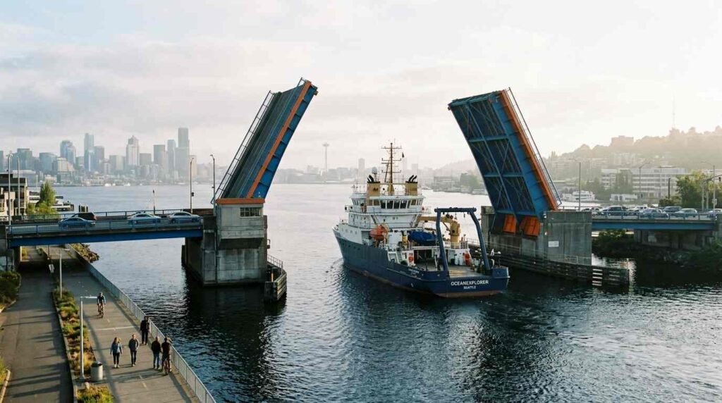
Fremont sits at the northern end of Lake Union, on both sides of the Lake Washington Ship Canal, roughly two miles from downtown Seattle. It was incorporated into Seattle in 1891, having grown from a streetcar suburb into a working commercial neighborhood with a strong manufacturing presence along the canal waterfront. The Fremont Bridge — a bascule drawbridge completed in 1917 — connects the neighborhood’s two halves across the canal and remains, by the City of Seattle’s own count, the most-opened drawbridge in the United States.
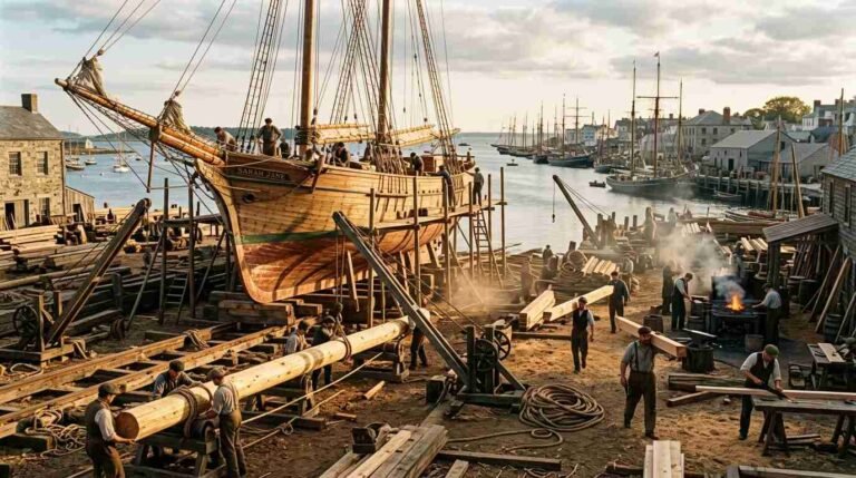
The neighborhood’s twentieth-century arc followed the familiar industrial-to-residential pattern. Manufacturing declined, populations shifted, and by the 1970s and 1980s Fremont had developed the low rents and high vacancy that make neighborhoods attractive to artists, musicians, small retailers, and the kind of anti-establishment cultural production that generates neighborhood identity. The Sunday Fremont Market, established in 1990, became one of the Pacific Northwest’s most significant outdoor markets. The Fremont Arts Council organized the Solstice Parade, which has run since 1989 and features hand-crafted floats, live music, and a procession of cyclists that has become a Seattle summer institution.
The public art installations that define Fremont’s visual character were acquired and installed during this period. The Fremont Troll — a concrete sculpture of a giant emerging from under the Aurora Bridge, crushing a Volkswagen Beetle in its fist — was installed in 1990, the result of a community art project. The Waiting for the Interurban figures at the north end of the bridge are a 1978 installation by Richard Beyer, depicting six commuters and a dog with a human face waiting for a streetcar that will never come. These installations are not incidental to Fremont’s identity — they are its landmarks, and they predate the neighborhood’s commercial success by a decade or more.
The Demographics the Census Data Shows
U.S. Census Bureau American Community Survey 5-year estimates for Census Tracts 55 and 56, which cover the core Fremont neighborhood, document the demographic shift from 2010 to 2020 with the clarity that only longitudinal tract-level data provides.
Between 2010 and 2020, the tracts covering Fremont showed consistent increases in median household income, educational attainment (measured as percentage of residents with a bachelor’s degree or higher), and median gross rent. The population grew — Seattle’s overall population grew significantly during this period, driven substantially by the expansion of Amazon and the broader tech sector in South Lake Union, immediately adjacent to Fremont. Fremont became a residential overflow for workers priced out of Capitol Hill and Ballard.
King County Assessor parcel data shows median residential sale prices in the Fremont area increasing significantly from the early 2010s through the early 2020s, tracking the overall Seattle market appreciation while maintaining a slight premium attributable to the neighborhood’s walkability score — which hovers consistently above 90 on the Walk Score index — and proximity to the Burke-Gilman Trail.
The demographic group that shrank is identifiable in the data but requires some inference: lower-income, long-term residents, artists, and the service workers who had occupied the neighborhood’s rental housing during its low-rent years. The data shows net population increase but rental cost increase of a magnitude that made the older resident population’s continued presence economically difficult. This is the standard displacement pattern — not evacuation, but pricing out, the slow replacement of one population with another over a decade rather than a season.
The Burke-Gilman Trail and the Ship Canal Waterfront
Fremont’s physical geography provides two assets that function as neighborhood infrastructure in ways that directly affect property values and resident quality of life.
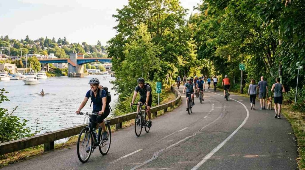
The Burke-Gilman Trail — a 27-mile paved multi-use path running from Ballard through Fremont, through the University District, and east toward Redmond — passes through the Fremont waterfront immediately north of the ship canal. The trail segment through Fremont is among the most heavily used in Seattle, providing car-free bicycle and pedestrian access to employment centers in both directions. Properties within two blocks of the trail segment consistently command premiums in King County parcel sale data.
The ship canal waterfront itself, including the stretch from the Fremont Bridge east toward Gasworks Park, is publicly accessible but has undergone significant commercial development pressure. Former industrial waterfront parcels have been converted to mixed-use development, tech office campuses, and market-rate residential. The Gas Works Park site — a former coal gasification plant converted to public parkland in 1975 — anchors the eastern end of this waterfront corridor and provides one of Seattle’s most architecturally distinctive public spaces: the rusting gasification towers left deliberately as industrial ruins within a landscape design by Richard Haag.
The Mandatory Housing Affordability Upzoning
The central political conflict in Fremont’s recent history is the Mandatory Housing Affordability (MHA) upzoning program, implemented by the Seattle Office of Planning and Community Development following years of environmental impact review and community opposition. The MHA program citywide allowed increased height and density in exchange for developer contributions to affordable housing — either on-site affordable units or payments into the city’s affordable housing fund.
In Fremont, the upzoning was concentrated along the commercial corridors and immediately adjacent residential blocks. The Seattle OPCD Mandatory Housing Affordability EIS records document the public comment process, which was prolonged and contentious. Fremont residents who had organized around neighborhood character — historic buildings, pedestrian scale, the specific visual identity of the Butler-Fremont commercial area — argued that increased height limits would destroy what made Fremont worth living in.
The opposition contained an inherent tension that the planning literature describes as the “exclusionary preservation” problem: the same neighborhood character that long-term residents sought to protect had been created precisely because the neighborhood was affordable enough to support artists, small retailers, and community organizations. Protecting the physical form of that character against densification served the interests of existing property owners — whose values increased with scarcity — while making the neighborhood less accessible to the population that had created its cultural value.
The MHA upzoning was implemented. Development has followed, though more slowly than critics feared and less affordably than advocates hoped.
Micro-Block Value Variation
Fremont is not a uniform real estate market within its boundaries, and King County Assessor data makes the variation visible at a granular level. The highest-value micro-zones cluster within two blocks of the ship canal waterfront and the Burke-Gilman Trail corridor. The block immediately north and south of the Fremont Bridge — where commercial retail, restaurants, and the public art installations concentrate — shows the highest assessed values for mixed-use commercial buildings.
Moving north along Fremont Avenue toward the 45th Street corridor, values moderate but have appreciated significantly since the MHA upzoning signals reduced supply constraints on development. The blocks east of Stone Way, which adjoin the Wallingford neighborhood rather than the canal waterfront, show lower residential values than the core Fremont blocks — though the gap has narrowed through the 2010s as both neighborhoods appreciated in tandem.
The dynamics operating in Fremont are not unique to Seattle, and not unique to the West Coast. The same tension between neighborhood character preservation and housing supply — between the interests of existing residents and the interests of those priced out — runs through the planning conversations happening in urbanizing markets from Brooklyn to Long Island’s own village centers, where density pressure is beginning to reshape commercial corridors that have looked the same for forty years.
You Might Also Like: The Ghost Station Capital | The Hudson Valley in Reverse