Nine meters beneath the cold, fast-moving waters off Brittany’s western tip, a retired geologist named Yves Fouquet was staring at something that shouldn’t exist. It was 2017, and Fouquet had been studying high-resolution seabed charts generated by France’s Litto3D program — a national initiative using LIDAR (Light Detection and Ranging) to build a precise three-dimensional reconstruction of the entire French coastline. Across his screen, laser-mapped contours of the ocean floor near Île de Sein revealed what geology could not explain: a ruler-straight line, 120 meters long, cutting cleanly across a submerged valley. Nature, as any geologist will tell you, does not do straight lines.
It would take five more years, 59 dives, and a team of ten divers from the Society of Archaeology and Maritime Memory (SAMM) to confirm what Fouquet suspected. Beneath the Atlantic, locked in position for more than seven millennia, sat the largest underwater stone construction ever identified in France — a massive granite wall that is now forcing archaeologists to rethink everything they assumed about Europe’s earliest coastal societies. And just ten kilometers to the east, in the Bay of Douarnenez, an ancient Breton legend has spoken for centuries of a magnificent city swallowed by the sea.
The question no one expected to ask is whether the legend remembers something real.
What the Lasers Found
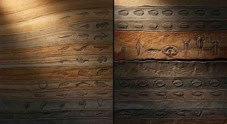
The study, published in December 2025 in the International Journal of Nautical Archaeology by Fouquet and colleagues, documents eleven submerged stone structures located on the Sein Causeway, a shallow underwater plateau west of Île de Sein (Fouquet et al., IJNA, 2025). The largest structure, designated TAF1, is a wall measuring 120 meters in length, approximately 20 meters wide, and averaging two meters in height. Its total mass is estimated at roughly 3,300 tons of carefully stacked granite blocks. What makes it extraordinary, beyond its sheer scale, are the more than 60 vertical monoliths and stone slabs that protrude from the wall’s crest, sometimes arranged in two parallel lines spaced about 1.5 meters apart. Some of these standing stones still rise nearly two meters above the surrounding structure despite seven thousand years of marine erosion.
Between 2022 and 2024, SAMM divers confirmed three additional large structures (TAF2A, TAF2B, and TAF3) in the same sector, all sharing similar construction techniques — stacked blocks reinforced by upright monoliths. A second group of smaller structures (YAG1, YAG2, YAG3B, and YAG3C) was also identified, each consisting of linear stone walls built from smaller blocks positioned to close off natural depressions or small valleys. One of these, YAG3C, extends 50 meters and features small monoliths spaced roughly a meter apart.
Because no organic material was recovered for radiocarbon dating, the research team used precise relative sea-level curves for western Brittany to estimate when the structures were built. The logic is elegant: if these walls functioned as fish traps or tidal barriers, their bases had to sit above the spring low-tide mark of their era to be operational. Cross-referencing the structures’ current depth with established sea-level data places construction between approximately 5800 and 5300 BCE — during the late Mesolithic and early Neolithic transition.
That dating carries a staggering implication. Brittany is famous for its megalithic monuments — the standing stones of Carnac, the dolmens and passage graves that dot the coastline. Those monuments date to the fifth millennium BCE. The submerged structures off Sein Island predate them by roughly 500 years, suggesting that the technical knowledge required to quarry, transport, and erect multi-ton granite slabs existed among Mesolithic hunter-gatherer communities centuries before the first recognized megaliths appeared on land.
Engineering Before Agriculture
The conventional archaeological narrative has long associated monumental stone construction with the Neolithic revolution — the arrival of agriculture, permanent settlements, and the social hierarchies that made large-scale labor projects possible. The Sein Island discovery upends that timeline. As archaeologist Yvan Pailler of the University of Western Brittany noted, the wall was built by a society of hunter-gatherers who became sedentary when local resources permitted (CBS News, 2025). The volume of stone moved — over 4,300 tons across TAF1 and TAF2A alone — and the technical sophistication of the construction imply a degree of social organization, collective planning, and specialized knowledge that challenges assumptions about pre-agricultural communities.
Two primary theories have emerged regarding the wall’s function. The first interprets the larger structures as elaborate fish weirs, stone barriers designed to funnel and capture fish as tides receded. The upright monoliths, under this hypothesis, would have supported latticed frameworks of wooden branches and netting. Fish weirs were common among Mesolithic coastal communities throughout Europe; comparable wooden examples dating to 6150–5750 BCE have been documented in Ireland. The second theory proposes the wall functioned as a protective coastal barrier against rising sea levels. During the period of construction, sea levels in western Brittany were rising at rates between 5.2 and 8.4 millimeters per year — fast enough that coastal populations would have witnessed significant shoreline loss within a single generation (Ancient Origins, 2025).
The two explanations are not mutually exclusive. A massive wall spanning a tidal valley could have served both purposes simultaneously — channeling fish and breaking wave energy. Either way, the engineering represents something far more sophisticated than opportunistic stone-stacking. The asymmetrical profile of TAF1, with its reinforced seaward flank, suggests deliberate design intended to resist storm forces. These builders were not merely occupying the coast. They were actively reshaping it.
The Drowned World Beneath the Baltic
The Brittany discovery does not exist in isolation. It belongs to a rapidly expanding catalog of submerged prehistoric structures across Europe, a pattern made visible almost entirely by advances in remote-sensing technology. In February 2024, researchers from the Leibniz Institute for Baltic Sea Research published their discovery of the “Blinkerwall” — a nearly kilometer-long stone wall resting 21 meters beneath the Bay of Mecklenburg in Germany’s Baltic Sea (Geersen et al., PNAS, 2024). Composed of approximately 1,500 stones, the Blinkerwall was constructed an estimated 10,000 to 11,000 years ago by Palaeolithic or early Mesolithic hunter-gatherers, likely as a drive lane for channeling migrating reindeer toward a lakeside ambush point.
The Blinkerwall’s discovery was itself a product of accident and technology. Marine geologist Jacob Geersen was teaching a field course aboard a research vessel in 2021 when students, mapping the seafloor with echo sounders during the night, noticed a long, regular ridge that could not be explained by glacial activity or modern construction. Subsequent dives confirmed the wall’s artificial origin: 288 large boulders — likely deposited by retreating glaciers — connected by over 1,600 smaller stones that appeared to have been deliberately gathered and positioned to fill the gaps between them. The resulting structure shows remarkable regularity over its entire length.
Together, the Brittany and Baltic discoveries rewrite the map of prehistoric Europe. They reveal that coastal and lakeside hunter-gatherer communities, operating with stone tools and no written language, were capable of organizing labor forces to construct monumental stone features — some stretching hundreds of meters — and that they did so thousands of years before the accepted dawn of European megalithic culture. The seabed, it turns out, has been preserving evidence that the land itself long ago surrendered to erosion and agriculture.
Kêr-Is: The Atlantis of Brittany
Ten kilometers east of where Fouquet’s wall lies submerged, the Bay of Douarnenez opens into the Atlantic. For centuries, perhaps millennia, the people of Brittany have told stories of a city that once stood in those waters — a city called Ys.
The legend of Ys, or Kêr-Is in Breton (literally “Low City”), is among the most enduring narratives in Celtic folklore. Multiple versions survive, but the central architecture of the story remains consistent: King Gradlon ruled over a wealthy coastal city built on land reclaimed from the sea. His palace was said to be made of marble, cedar, and gold. To protect the city from flooding, an elaborate system of dikes and sluice gates had been constructed, controlled by a single key held by the king. His daughter Dahut — beautiful, willful, and, in later Christian retellings, sinful — either stole the key to admit a lover or was tricked by a demonic figure into opening the gates at high tide. The ocean rushed in. Gradlon, warned by the monk Gwénnolé, escaped on horseback. Dahut was cast into the waves, where she became a sea spirit. Ys vanished beneath the water forever.
The oldest versions of the legend, predating Christian interpolation, describe Ys as having been founded more than two thousand years before Gradlon’s reign in a location that was dry at the time but had gradually been encroached upon by the sea. Nineteenth-century folklorists recorded Breton beliefs that during extreme low tides, the ruins of Ys could still be seen, or the sound of its bells heard ringing beneath the surface. The legend inspired Claude Debussy’s 1910 prelude La cathédrale engloutie (The Sunken Cathedral) and has permeated Breton cultural identity for generations.
What makes the legend scientifically interesting is not the story of Dahut or the moralizing about sin and divine punishment — those are the accretions of centuries of Christian storytelling layered onto older oral material. What matters is the substrate: a persistent, geographically specific cultural memory of a structured coastal settlement that was lost to the rising sea.
The Edge of Memory
Can an oral tradition preserve factual information for seven thousand years? The question sounds absurd in a world built on written records, digital archives, and institutional memory measured in decades. But a growing body of research suggests the answer may be yes — under specific cultural conditions.
Patrick Nunn, professor of Oceanic Geoscience at the University of the Sunshine Coast in Australia, has spent more than a decade documenting cases where indigenous oral traditions appear to encode accurate memories of post-glacial environmental change. In a landmark study, Nunn and linguist Nick Reid identified 21 Aboriginal Australian stories that describe specific coastal locations at times when sea levels were significantly lower than today. By cross-referencing the stories’ geographical details with reconstructed sea-level data, they estimated that some of these oral traditions may preserve memories dating back 7,000 to 13,000 years (Nunn and Reid, Australian Geographer, 2016). The Ngarrindjeri people, for example, tell of a time when Kangaroo Island was connected to the mainland — a geographical reality that ended approximately 10,000 years ago.
In his 2018 book The Edge of Memory: Ancient Stories, Oral Tradition and the Post-Glacial World, Nunn expanded his analysis to include northwest European coastal folklore, arguing that Brythonic (Celtic and Breton) cultures — like Aboriginal Australian cultures — occupied relatively isolated positions at the margins of global human interaction for the past ten thousand years. This isolation, he contends, created optimal conditions for the preservation of ancient oral knowledge across hundreds of generations. Nunn specifically cited the legend of Ys as a possible example, noting that Breton folklore about sunken cities correlates with the documented submergence of coastal landscapes during the sixth and fifth millennia BCE.
The Fouquet study echoes this reasoning directly. The researchers write that the abandonment of a territory developed by a highly structured society would have become deeply rooted in cultural memory, and that the submersion caused by rising sea levels, followed by the loss of fishing structures, protective works, and habitation sites, would have left a lasting impression on the communities who witnessed it (Fouquet et al., IJNA, 2025). They further cite a 2022 study suggesting that oral traditions describing ancient submergences could preserve events dating back 5,000 to 15,000 years.
This is not a claim that Ys was a real city with marble palaces and golden halls. It is something more subtle and, in many ways, more remarkable: the possibility that a real event — the gradual drowning of an engineered coastal landscape inhabited by a sophisticated society — imprinted itself so deeply on the communities who survived it that traces of that memory persisted through oral transmission for five to seven millennia, accumulating layers of mythology, Christian moralizing, and literary embellishment along the way, but never entirely losing the geographical and experiential kernel at its core.
LIDAR as Time Machine
The convergence of the Brittany discovery and the Ys legend is made possible by a technology that did not exist thirty years ago. LIDAR — the same technology used in autonomous vehicle navigation, forestry management, and urban planning — has become one of the most transformative tools in modern archaeology. By emitting rapid pulses of laser light and measuring their return time, LIDAR systems generate three-dimensional maps of surfaces with centimeter-level precision. In terrestrial applications, airborne LIDAR can penetrate dense forest canopies to reveal buried structures invisible to satellite imagery or ground-level survey. In marine applications, bathymetric LIDAR and LIDAR-derived seabed charts can identify artificial features — straight lines, regular geometries, anomalous formations — that the human eye would never detect beneath meters of water and centuries of sedimentation.
France’s Litto3D program, which generated the charts Fouquet was studying in 2017, represents a national commitment to mapping the country’s entire coastline and shallow seabed at high resolution. It was the unusual linearity of the features on those charts — the geometric regularity that geology could not account for — that first flagged the Sein Island structures as potentially artificial. Without LIDAR, the wall would still be invisible, its monoliths standing in cold Atlantic darkness, visited only by fish and currents.
The pattern is repeating worldwide. In the Amazon, LIDAR surveys in 2024 revealed over 6,000 interconnected earthen platforms dating back two thousand years, buried beneath rainforest canopy (HISTORY, 2024). In Honduras, airborne LIDAR confirmed the existence of La Ciudad Blanca, the legendary “Lost City of the Monkey God,” hidden under dense vegetation for centuries. In the Aegean, LIDAR is being used to survey uninhabited Cycladic islands, revealing ancient sanctuaries and Roman fortifications. And beneath the waters of Lake Huron, submerged stone hunting structures comparable to the Baltic’s Blinkerwall have been documented using similar remote-sensing approaches.
Each of these discoveries shares a common thread: technology is outpacing mythology. The legends came first — stories of lost cities, vanished landscapes, drowned worlds. The lasers came second. And in case after case, the lasers are finding something where the stories said to look.
What the Stones Remember
There is a Breton saying about Île de Sein: Qui voit Sein, voit sa fin — “Who sees Sein, sees their end.” The island sits at the edge of the continental shelf, surrounded by the treacherous reefs of the Chaussée de Sein, where countless ships have been wrecked across the centuries. The first-century Roman geographer Pomponius Mela wrote that the island was home to an oracle staffed by nine virgin druidesses who could heal the sick, speak with the dead, and summon storms. Even in antiquity, Sein carried the weight of something older than memory.
Now, 1.9 kilometers west of that island, standing stones older than Carnac rise from the seafloor in parallel rows. A wall that took thousands of tons of granite to build still spans a valley that has been submerged for seven thousand years. And ten kilometers to the east, a legend persists about a city built on reclaimed land, protected by engineered walls, and ultimately surrendered to the rising ocean.
The researchers are careful to maintain the boundary between science and storytelling. Lead author Fouquet told journalists plainly that his discoveries are based on what can be scientifically proven, and that legend is legend, enriched by the additions of human imagination over centuries (404 Media, 2025). But the study’s final pages allow for a more evocative possibility: that the submerged structures allow scholars to question the origin of the Ys legend not from historical legends and their numerous additions, but from scientific findings that may be at the origin of this legend (Fouquet et al., IJNA, 2025).
What LIDAR has given us is not proof that Ys existed. It has given us something more useful: physical evidence that the coastline of western Brittany was once home to a structured, stone-building society that was progressively displaced by rising seas during the sixth millennium BCE — precisely the kind of event that, according to Nunn’s research, oral traditions are capable of preserving for thousands of years. The monoliths off Sein Island do not validate the tale of Gradlon and Dahut. They validate the possibility that behind the tale, compressed and distorted by millennia of retelling, lies a real loss — a real landscape, a real community, a real drowning.
The sea took the stones. The people kept the story. And now the lasers are finding both.
Sources
Fouquet, Y. et al. (2025). “Submerged Stone Structures in the Far West of Europe During the Mesolithic/Neolithic Transition (Sein Island, Brittany, France).” International Journal of Nautical Archaeology. https://hal.science/hal-05406477
Geersen, J. et al. (2024). “A Submerged Stone Age Hunting Architecture from the Western Baltic Sea.” Proceedings of the National Academy of Sciences, 121(8). https://www.pnas.org/doi/10.1073/pnas.2312008121
Nunn, P.D. and Reid, N.J. (2016). “Aboriginal Memories of Inundation of the Australian Coast Dating from More Than 7000 Years Ago.” Australian Geographer, 47(1), pp. 11–47.
Nunn, P.D. (2018). The Edge of Memory: Ancient Stories, Oral Tradition and the Post-Glacial World. Bloomsbury Sigma.
Nunn, P.D. (2022). “The Oldest True Stories in the World.” SAPIENS. https://www.sapiens.org/language/oral-tradition/
“Network of Submerged Stone Structures Rewrites Early European Prehistory.” HeritageDaily, December 11, 2025. https://www.heritagedaily.com/2025/12/network-of-submerged-stone-structures-rewrites-early-european-prehistory/156573
“Scientists Discover Massive Underwater Ruins That May Be a Lost City of Legend.” 404 Media, December 18, 2025. https://www.404media.co/scientists-discover-massive-underwater-ruins-that-may-be-a-lost-city-of-legend/
“Massive 7,000-Year-Old Wall Found Underwater Off French Coast.” Ancient Origins, 2025. https://www.ancient-origins.net/news-history-archaeology/underwater-wall-france-00102387
“Divers Discover Massive 7,000-Year-Old Undersea Wall Off Coast of France.” CBS News, December 14, 2025. https://www.cbsnews.com/news/ancient-undersea-wall-found-coast-of-france/
“Ancient Sea Rise Tale Told Accurately for 10,000 Years.” Scientific American, 2015. https://www.scientificamerican.com/article/ancient-sea-rise-tale-told-accurately-for-10-000-years/
“A Massive Stone Wall Built 7,000 Years Ago Was Found Intact Beneath the Sea Off the Coast of France.” ZME Science, December 24, 2025. https://www.zmescience.com/science/archaeology/old-stone-wall-beneath-the-waves-france/
“Archaeologists Discover Mysterious 7,000-Year-Old Stone Wall Beneath the Waves Off the Coast of France.” Smithsonian Magazine, December 31, 2025. https://www.smithsonianmag.com/smart-news/archaeologists-discover-mysterious-7000-year-old-stone-wall-beneath-the-waves-off-the-coast-of-france-180987930/